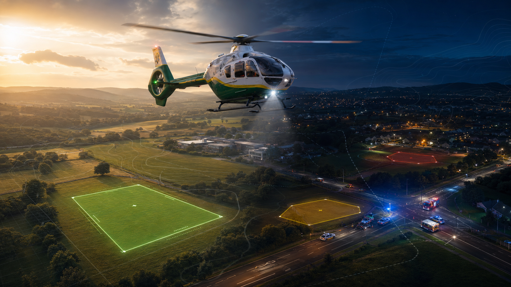
Air ambulance crews routinely operate into locations that were never designed as helicopter landing sites.
A road traffic collision, rural casualty, industrial incident, sporting injury or medical emergency may require the aircraft to land in a field, public open space, school playing field, car park or other ad hoc location close to the incident.
In daylight, crews may be able to assess many of those factors visually as they arrive. They can look at the ground, surrounding obstacles, wires, slope, surface, approach and departure options before committing to land.
At night, the problem becomes more demanding. The aircraft may still need to land close to the patient, but the crew has less visual information available, less time to interpret the surrounding ground, and greater reliance on prior knowledge, procedure and airborne reconnaissance.
That is where pre-arrival landing site intelligence becomes important.
The operational challenge
For air ambulance operations, the question is rarely as simple as “where is there open ground?”
The better question is: Where is there a potentially suitable landing site for this aircraft, in these conditions, close enough to support the task? A site that looks useful on a map may not be practical once the wider factors are considered.
The area might be too small for the aircraft’s D-value. It could be acceptable in daylight but unsuitable at night, or have a gradient that makes landing impractical. It may be affected by trees, wires, nearby buildings, surface conditions or poor access from the landing site to the patient.
Access is often overlooked. A school playing field, for example, may appear ideal from an aviation perspective, large, flat and relatively free from obstacles. However, if the crew lands inside a fenced site and cannot get out, or if the nearest usable gate is on the wrong side of the field, the site may be less useful operationally.
Landing site assessment, therefore, needs to consider more than the landing area itself. It also needs to consider how the site connects to the incident.
Why night operations change the problem
Night operations place greater value on pre-planning and structured information.
In daylight, the crew may be able to interpret the landing environment more readily during the approach. At night, terrain, boundaries, wires, trees, fences and access points can be harder to identify and assess quickly.
This does not remove the need for airborne reconnaissance. Before committing to land, the pilot and crew still need to assess the site, including the landing area, surface, slope, obstacles, approach, departure and downwash risks.
HLS-PRAS does not replace that judgment.
Its role is to improve the information available before that final assessment begins.
By identifying candidate landing sites in advance, based on terrain, gradient, aircraft D-value and other agreed criteria, HLS-PRAS can help crews, control rooms and planning teams understand potential options before the aircraft is overhead.
The aircraft may still need to conduct a circuit or airborne reconnaissance before landing. The difference is that the crew is not starting from a blank map.
Aircraft D-value matters
Aircraft size should not be treated as a generic value.
For helicopter landing site planning, the aircraft’s D-value is a key factor. Where relevant, day D-value and night D-value need to be considered separately, because the space required and the operational criteria may differ.
This is important for air ambulance organisations operating different aircraft types, or where planning criteria change between day and night operations. A site that may be suitable for one aircraft may not be suitable for another. Furthermore, a site that may be suitable during daylight may not be appropriate at night.
HLS-PRAS allows landing site analysis to be carried out against defined aircraft criteria, rather than relying only on a visual impression of whether an area looks large enough.
Turning regional data into usable options
Air ambulance services operate across large areas.
No crew, control room, or planning team can rely entirely on memory or informal local knowledge across a full operational region. Even where crews know common landing locations, incidents do not always occur near familiar sites.
HLS-PRAS can support regional landing site analysis by identifying candidate sites across an area of operation.
This can help teams understand where potential options may exist before they are needed. It can also support training, operational review and pre-planning for areas where access, terrain or night operations may create additional challenges.
The output is not an approved landing site list. It is a structured intelligence layer that helps narrow the search and support informed decision-making.
Software or prepared outputs
There are two broad ways this capability can be used. The first is through HLS-PRAS software, allowing users to conduct their own analysis, review locations and assess candidate landing sites based on agreed criteria.
The second is as a service. For organisations that need the output rather than the software platform, CRSL can generate regional helicopter landing site data using agreed parameters. These may include aircraft D-value, day and night requirements, gradient and other operational criteria.
The output can be supplied as geospatial data, including KMZ files, for use in compatible operational systems such as Airbox ACANS. That means candidate landing site information can be made available within existing operational workflows, rather than sitting in a separate planning process.
Supporting, not replacing, operational judgement
Air ambulance operations require fast decisions, but those decisions still sit with the professionals responsible for the task.
HLS-PRAS does not remove pilot judgment. It does not remove airborne reconnaissance nor does it guarantee that a site is safe, accessible or available at the point of use. What it does is provide a stronger starting point.
It helps identify potential landing sites based on terrain, gradient, aircraft D-value and other data-led factors. It helps show where options may exist, where constraints may apply, and where further assessment may be needed.
For daytime operations, it can improve situational awareness. For night-time operations, it can be even more valuable, because the crew and control room have better information before the final airborne assessment begins.
Better landing site awareness before it is needed
The practical value of HLS-PRAS is in reducing uncertainty before the pressure builds.
Air ambulance crews may still need to land in unfamiliar locations, close to time-critical incidents, in difficult conditions and often at night. The planning should not start when the aircraft arrives overhead.
By using geospatial data to identify candidate landing sites in advance, HLS-PRAS helps turn terrain, gradient, D-value and access considerations into operationally useful intelligence.
That gives crews, control rooms and planning teams a better starting point the yet final decision remains with the crew. The information available before that decision can still be improved.
If you would like to explore the planning challenge further, we would be very happy to discuss the problem in more detail and, where useful, arrange a demo. Call +44 (0)1794 834750 or email enquiries@cunningrunning.co.uk. You can also follow Cunning Running Software Ltd on LinkedIn, or connect with Phil Cowell or John Overend.