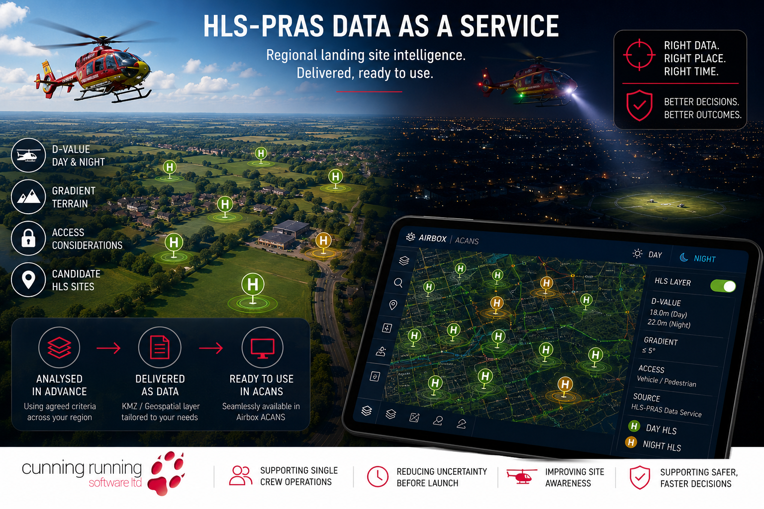
Not every organisation needs another software platform. Sometimes the requirement is simpler:
Can the potential helicopter landing site data be produced, maintained and delivered in a format that works inside existing operational systems?
For air ambulance organisations, emergency planners, military users and wider resilience teams, this can be a practical way to make landing site intelligence available without placing another tool directly into the operational workflow.
That is where helicopter landing site analysis as a service becomes valuable.
Instead of asking every user to carry out the analysis themselves, CRSL can generate regional helicopter landing site data based on agreed criteria, including aircraft D-value, day and night requirements, gradient and other operational parameters.
The result can be delivered as geospatial data, including KMZ files, for use in compatible systems such as Airbox ACANS. The aim is not to create a fixed list of approved landing sites. The aim is to provide a structured, data-led starting point.
From software capability to prepared output
HLS-PRAS allows users to assess terrain, gradient and available space against aircraft-specific criteria.
For some organisations, operating that capability directly will be the right answer. It gives planning teams the ability to assess locations, review options, test different aircraft criteria and update analysis as requirements change.
For others, the immediate need may be the output rather than the software.
A regional landing site dataset can give crews, control rooms and planning teams access to candidate landing site information without requiring every user to interact with the analysis tool directly. That can be particularly useful where information needs to be made available quickly, consistently and within existing operational systems.
Why regional analysis matters
Air ambulance operations cover large and varied areas.
A single region may include cities, towns, villages, rural roads, industrial sites, schools, sports grounds, open farmland, coastal areas and remote terrain. Some locations may be well known to crews. Others may only become relevant when an incident occurs nearby.
Relying entirely on memory, local knowledge or manual map checks creates inconsistency. It also places more pressure on crews and control rooms when time is already limited. Regional analysis helps move some of that work upstream.
By assessing a wider area in advance, organisations can build a better understanding of where candidate landing sites may exist before they are needed.
That becomes particularly valuable during night operations, where the crew may have less visual information available during the final approach and greater reliance on pre-arrival awareness.
D-value, gradient and night requirements
Aircraft size should not be treated as a rough visual estimate.
For helicopter landing site planning, the aircraft’s D-value is a key parameter. Where relevant, day D-value and night D-value should be considered separately, because the space and operational requirements may differ.
Gradient is also central to the analysis. A location may appear suitable on a map, or even from the air, but terrain can still make it unsuitable or less practical. A regional analysis can apply agreed criteria consistently across a defined area. That may include:
Aircraft D-value.
Day and night requirements.
Gradient.
Available landing area.
Terrain constraints.
Proximity to likely areas of operation.
Access considerations where data is available.
The output remains a planning and decision-support layer. It does not remove the need for pilot judgement, airborne reconnaissance or local verification. It does, however, provide a more informed starting point.
Turning landing site intelligence into a usable layer
Data only has value if it can be used.
A regional HLS dataset can be supplied in formats that are compatible with existing geospatial and operational systems. One practical option is KMZ, allowing candidate landing site information to be viewed as a map layer in compatible systems such as Airbox ACANS.
That matters because users do not always need another planning environment. In many cases, they need the intelligence to appear in the system already being used to support operational awareness.
A prepared map layer can help show potential landing site options near an incident, along a route, around a community, or across a wider operational region.
This does not guarantee that a site will be available, accessible or suitable at the point of use. Gates may be locked. Ground conditions may have changed. Temporary obstacles may be present. Local activity may make the site unsuitable.
Those limitations should be understood clearly. The value is that the search does not begin with a blank map.
Access still matters
One of the practical issues with landing site planning is access.
A school playing field may appear to be an ideal candidate site. It may be flat, open and close to the incident. However, if the crew lands inside a fenced area and cannot get out, or if the nearest usable gate is on the wrong side of the site, the location may be less useful operationally.
Where suitable data is available, access can be considered as another planning layer.
Entry points, vehicle access, pedestrian access, footpaths, roads and surrounding land use can all help build a more realistic picture of how a landing site might function in practice.
There will always be limitations. Mapping data may not confirm whether a gate is locked, whether access is available out of hours, or whether local arrangements are in place. Even so, considering access early can improve the quality of the planning discussion.
Supporting control rooms, crews and planners
A regional landing site dataset can support several different users.
For control rooms, it can provide faster awareness of candidate landing site options near an incident.
For crews, it can give useful pre-arrival context before the final airborne assessment begins.
For planning teams, it can support regional review, exercises, familiarisation and discussions with local partners.
For wider resilience users, it can support planning around major incidents, public events, remote locations, infrastructure sites and temporary operating areas.
The same principle also applies beyond air ambulance operations.
Military and security users may need landing site intelligence for troop insertion, extraction, casualty evacuation, forward operating locations or temporary helicopter operations. In those cases, the landing site layer can also sit alongside wider force protection and vulnerability assessment.
A practical route into HLS capability
Helicopter landing site analysis as a service provides a practical route for organisations that want the intelligence but do not need to run the software directly.
It allows a region to be assessed against agreed criteria.
It allows outputs to be delivered in usable geospatial formats.
It allows candidate landing site information to be viewed within compatible operational systems.
Most importantly, it helps shift the planning process earlier.
The final decision still sits with the pilot and crew.
Airborne reconnaissance still matters.
Local verification still matters.
Operational judgement still matters.
The purpose of the data is to improve the information available before those decisions are made.
For daytime operations, that improves awareness.
For night operations, it may be even more valuable.
The aircraft may still arrive first.
The landing site intelligence does not need to arrive last.
If you would like to explore the planning challenge further, we would be very happy to discuss the problem in more detail and, where useful, arrange a demo.
If you would like to explore the planning challenge further, we would be very happy to discuss the problem in more detail and, where useful, arrange a demo. Call +44 (0)1794 834750 or email enquiries@cunningrunning.co.uk. You can also follow Cunning Running Software Ltd on LinkedIn, or connect with Phil Cowell or John Overend.