In our previous article, the focus was on why Counter-UAS capability starts with planning rather than equipment.
The next step is understanding what that planning is actually based on.
At the centre of any effective Counter-UAS assessment is a clear understanding of the physical environment. Terrain, structures, vegetation, and infrastructure do not just form the backdrop to the problem. They actively shape how a drone threat presents itself, how it moves, and how effectively it can be detected and tracked.
This is where the concept of the battlespace becomes important.
A drone does not operate in isolation. Its effectiveness, and the effectiveness of any response to it, is heavily influenced by what is happening on the ground.
The ground still shapes the air threat
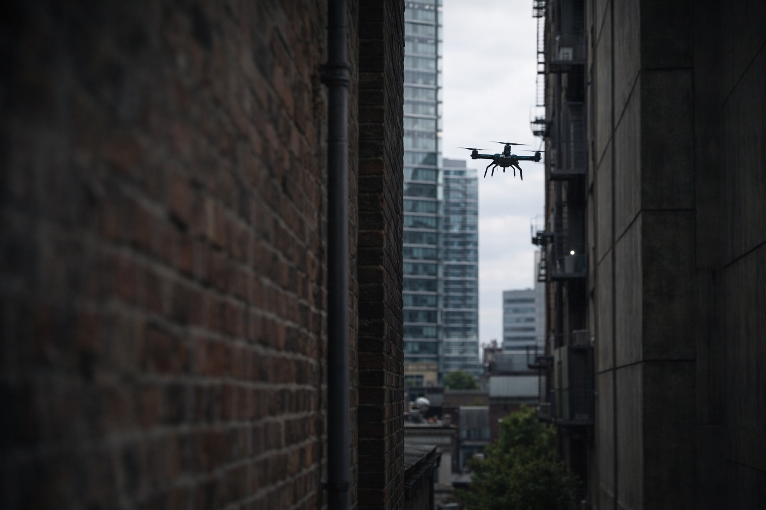
It is easy to assume that drones, by operating in the air, are less constrained by the physical environment. In reality, the opposite is often true.
Urban environments introduce significant complexity. Buildings create masking, reflections, and clutter. Streets and open spaces channel movement. Elevated positions offer an advantage to both operator and sensor.
Rural environments present a different set of challenges, including long sightlines, rolling terrain, vegetation, and limited infrastructure.
In both cases, the physical environment dictates what can be seen, what can be tracked, and where capability needs to be focused. Ignoring that leads to flawed assumptions about coverage.
Dead ground is the real problem
One of the most common weaknesses in Counter-UAS deployments is the presence of dead ground.
Dead ground refers to areas that are not visible or detectable due to terrain, structures, or other forms of obstruction. These areas create natural gaps in coverage, regardless of how capable the sensor may be.
A sensor may have a strong nominal range, but if it is positioned where terrain masks part of the environment, that range becomes irrelevant in those directions.
In urban areas, dead ground is often created by buildings, infrastructure, and clutter. In rural or semi-rural environments, it is more likely to be caused by elevation changes, vegetation, and terrain features.
In both cases, dead ground is not an edge case. It is a defining feature of the problem.
Understanding likely threat routes
Drone threats are not random. Operators will tend to select routes that reduce exposure and increase their chances of success.
That often means using terrain and structure to their advantage.
Approach routes may follow low ground, use built-up areas for concealment, or take advantage of gaps in visibility created by terrain or infrastructure. Launch points are likely to be chosen based on access, concealment, and line of sight to the target.
If those routes are not identified during planning, detection and tracking capability may be focused on the wrong areas.
This is where many deployments fall short. Coverage is often designed around the protected site itself, rather than the wider environment that shapes how a threat will approach it.
Visibility is not uniform
Another common assumption is that coverage is consistent across an area.
In reality, visibility varies significantly depending on position, elevation, and obstruction.
A location that provides excellent coverage in one direction may be heavily restricted in another. Slight changes in elevation or placement can have a disproportionate impact on what can and cannot be seen.
Without proper analysis, these variations are difficult to identify. On paper, coverage may appear sufficient. In practice, there may be gaps that are only revealed once the system is in place.By that point, the opportunity to correct them is more limited and often more costly.
From environment to decision-making
Understanding terrain, dead ground and threat routes is not an academic exercise. It directly informs how Counter-UAS capability should be deployed.
It influences where sensors are positioned, where tracking needs to be strongest, and where intervention options should be available. It also informs where coverage overlap is required to reduce risk and where priority should be given based on vulnerability and consequence.
Without this understanding, deployment becomes reactive rather than deliberate.
With it, decisions become more targeted and more defensible.
Planning with intent
Effective Counter-UAS planning treats the environment as a key input, not a constraint to be worked around later.
That means analysing the battlespace properly before deployment begins. Identifying dead ground, understanding likely threat routes, and recognising where visibility is limited or inconsistent.
It also means accepting that coverage will never be perfect. The aim is not to eliminate all gaps, but to understand them and manage them in line with the operational requirement.
That is where planning moves from theory into practice.
In the next article in this series, the focus will move to how sensors, trackers and effectors can be positioned more effectively, and why siting decisions have a direct impact on overall Counter-UAS performance.
If you would like to explore the planning challenge further, we would be very happy to discuss the problem in more detail and, where useful, arrange a demo. Call +44 (0)1794 834750 or email enquiries@cunningrunning.co.uk. You can also follow Cunning Running Software Ltd on LinkedIn, or connect with Phil Cowell or John Overend.