Optimising Counter-UAS and Sensor Suites with FPPT
Counter-UAS capability is often discussed in terms of technology. New radars, better cameras, smarter effectors. In practice, most failures in counter-UAS operations are not caused by poor equipment, but by poor placement. Sensors that cannot see, systems that do not overlap, and defences that look robust on paper but leave critical gaps on the ground.
FPPT addresses this problem by treating counter-UAS and sensor planning as a spatial and behavioural challenge, not a procurement exercise.
The real problem with C-UAS planning
Across defence and security environments, counter-UAS systems are frequently deployed incrementally. A sensor is added where infrastructure allows, another where power is available, another where coverage is assumed rather than proven. The result is often a patchwork of detection zones with unrecognised dead ground between them.
Detection alone is also frequently misunderstood. Detecting a drone is not the same as recognising its intent, identifying its operator, or having the time and authority to respond. Each of those stages has its own spatial and temporal constraints, all of which are shaped by terrain, clutter and line of sight.
FPPT exists to make those constraints visible.
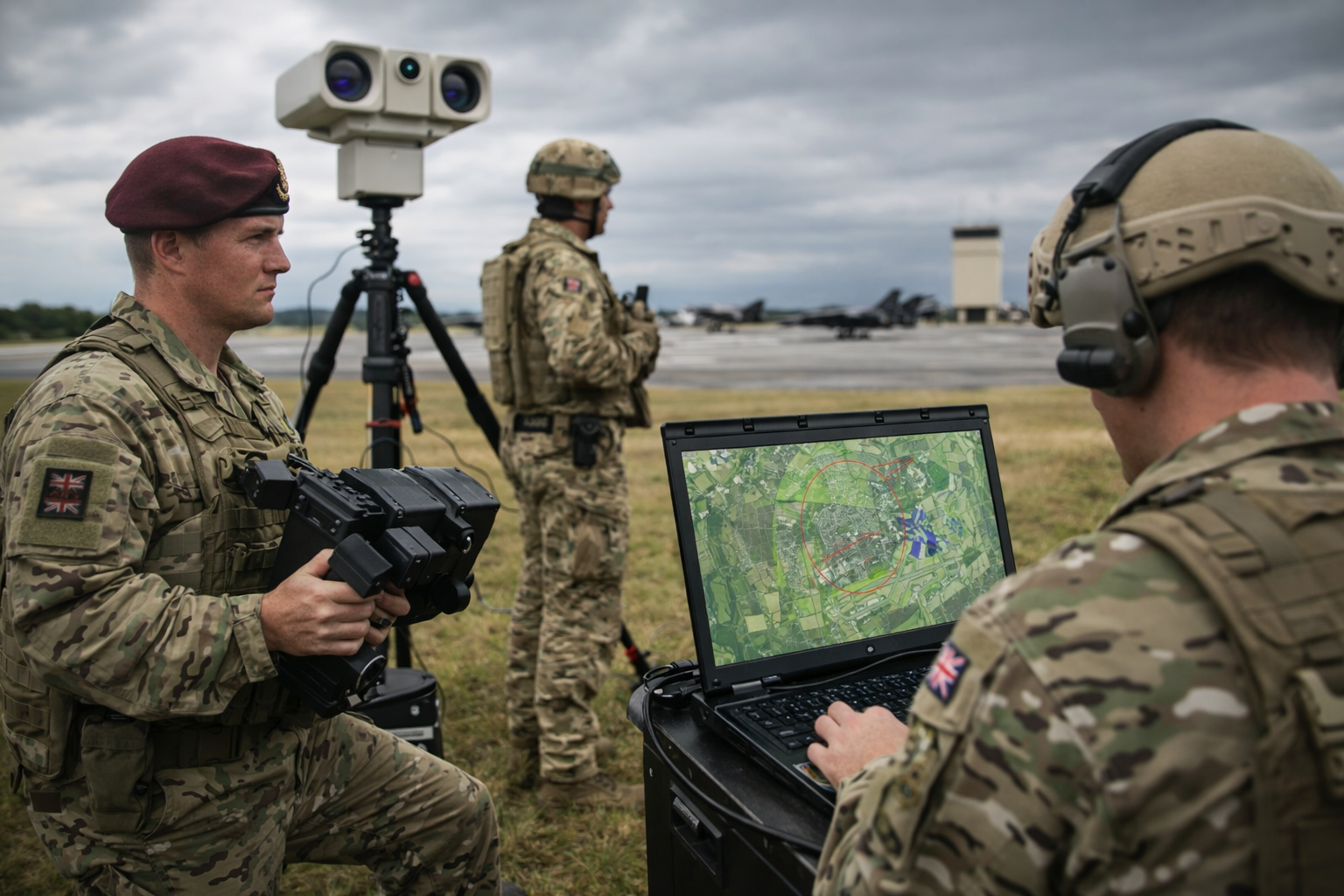
Detection, recognition and identification footprints
Not all sensor coverage is equal. A radar may detect movement at long range but struggle to discriminate targets in cluttered terrain. Electro-optical and infrared systems may provide excellent identification but only within limited arcs or distances. Acoustic or RF sensors are similarly shaped by terrain, buildings and background noise.
FPPT allows planners to model these detection, recognition and identification footprints accurately against real terrain and surface data. Elevation, vegetation, urban structures and water features are all factored into the analysis. This produces a realistic picture of where sensors actually work, not where they are assumed to work.
The result is a layered understanding of coverage rather than a single, misleading circle on a map.
Seeing overlaps and dead ground
One of the most valuable outcomes of FPPT analysis is the ability to visualise overlap and dead ground clearly. Overlapping coverage is essential for confirmation and resilience. Dead ground is where adversaries will operate.
FPPT exposes both. It highlights areas where multiple sensors genuinely reinforce each other and areas where gaps exist due to terrain masking or poor siting. These insights often challenge long-held assumptions and force early, constructive conversations about risk.
Dead ground identified during planning is far cheaper to address than dead ground discovered during an incident.
Optimising detectors and effectors together
Counter-UAS planning does not stop at detection. Sensors and effectors must be planned as a system. Detection without a viable response plan is simply early warning of failure.
FPPT allows users to assess how detection zones align with effector engagement envelopes, response times and authority boundaries. This ensures that when a drone is detected, there is a realistic path to mitigation rather than a theoretical one.
By modelling detectors and effectors together, planners can test different configurations, understand trade-offs and justify decisions with evidence rather than assumption.
Modelling adversary UAS behaviour
Small unmanned aerial systems are not random. Operators select launch points, routes and profiles based on risk, concealment and expected success. Terrain masking, urban clutter and predictable patrol patterns all influence adversary behaviour.
FPPT supports the modelling of likely UAS launch areas and approach routes based on terrain analysis and known behaviours. This shifts planning from reacting to detections to anticipating intent. It also helps prioritise surveillance and sensor placement towards areas of highest risk rather than spreading resources thinly.
Understanding how an adversary is likely to think is just as important as understanding what equipment they may use.
Friendly UAS and deconfliction
Modern operations increasingly involve friendly UAS operating alongside counter-UAS systems. Without careful planning, this creates the risk of self-interference, misidentification or unnecessary restrictions on friendly air activity.
FPPT supports friendly UAS planning within the same spatial framework. This enables clear deconfliction between surveillance, logistics or search drones and counter-UAS systems, reducing friction while maintaining protection.
This capability is particularly valuable in complex environments where military, police and other agencies operate together.
From reactive defence to deliberate planning
Effective counter-UAS posture is built before deployment, not during an incident. FPPT enables that shift by providing a structured environment in which sensor siting, coverage, overlap and response can be assessed, tested and refined.
Plans can be updated as threats evolve, new sensors are introduced or operational priorities change. The outcome is not a static diagram but a living, evidence-based plan that commanders can trust.
Conclusion
Counter-UAS success is rarely about having more sensors. It is about understanding where sensors work, where they do not, and how adversaries will exploit the gaps.
FPPT provides commanders and planners with the ability to visualise sensor coverage, optimise placement, integrate effectors and anticipate UAS behaviour using real terrain data. It turns counter-UAS planning from an assumption-driven exercise into a deliberate, defensible process.
Seeing the drone before it sees you is not luck. It is planning.
If you would like to explore this further, we would be happy to arrange a demo. Call us on +44 (0)1794 834750 or email enquiries@cunningrunning.co.uk.
Alternatively, connect with us on LinkedIn and follow the Cunning Running company page, or the LinkedIn pages of Phil Cowell or John Overend.